Having dropped off the AE86 Corolla for alignment at Pacific Automotive in Mapunapuna, I found myself with time to kill with my bike. Dave had suggested an interesting idea, I should go check out the Moanalua Valley trail that had within the past couple years turned into an open public DLNR trail. What the heck, just as good a place as any to go riding! I did end up taking a bit of a road detour by going to Toyota parts in Mapunapuna for a part for the Corolla, and ending up riding to Sand Island to go get it. I’ll call it a warm up. On my little side trip, I ride past a white civic stranded jammed up on high sidewalk by the veteran park entrance, and later an unaturaly gleeful shoping cart pushing lady. Ah the adventures of riding on Nimitz.
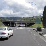 Picked up my part and rode back through Mapunapuna and headed into Salt Lake. It’s largely uphill, but I come to the freeway soon enough. Passing under it, it was a nice respite from the sun which was approaching noon and becoming pretty hot. Cruise past Moanalua Golf Course, I notice there’s a bike lane painted on the road, not that it means all that much to the cars that go past and encroach into it. From here on it’s a steady uphill pedal to the park at the end of the road.
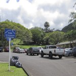
The park was filled with a family picnic/party and the parking lot was packed. No problem for me. I spotted the trail marker signs and skirt along the left side of the park to it. There a chainlink fence with gate and a pedestrian access to squeeze through on the right. Once through, you are now on what is named the Kamananui Valley Road. 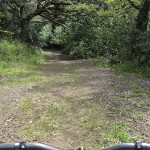 Wide gravel road, beginner level, like a ride in the park. It is nice that it is under canopy cover. After a short ride, I come to a fork in the trail. The left fork is a single track while the right looks to be a continuation of the road. I decide to stick to the road for now. I soon find out what is going on. The road dips down to a stream crossing, while the left single track goes to a concrete foot bridge that crosses the stream.
 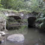 This was the first of supposedly 25 total crossing for the trail. I lose count somewhere around the 8th. Couple miles in I also see a number of pretty well worn side trails on the right/east side of the road. I take a snack break. This season has been a dry one and the trail has barely a trace of mud. I find some in the shade here where I’m munching my bar, but all the stream crossings have been dry with only standing water under the bridges.
 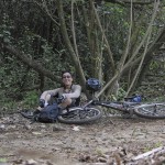 The conditions are pretty pleasant, the canopy cover keeps the sun out. Right after I resume riding, the road comes out into a large grassy clearing. There’s a couple of hunters trucks parked, and there is a very clear side trail to the east. I stick to the main road and find a bit more mud. A short distance later find the trail marker for the Kulana’ahane Trail on the left side. I take a peak, it crosses a dry stream bed quickly dissapears into the brush.
 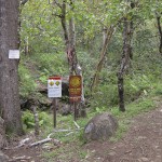 I decide to continue on the road and maybe investigate on my way back.
Things start to get a little wetter, the stream crossings now have some water in them. The road also got steep in places. I pass a group of hunters and dogs, they are searching for some of their dog(s) that have gone missing. After a distance, maybe a bit less than a mile, the road comes to a final fork. I turns off sharply to the right over a concrete strip over stream crossing. The trail that continues straight into the valley looks pretty travelled, so I decide to check it out. The jungle growth quickly narrows in. Although moderately well worn, the trail is strictly foot traffic from here on in. 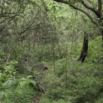 I think I’m the only fool to attempt to take my bike in, there are no signs of bicycle tracks here. The trail runs alongside a streambed, so it is pretty rocky and the heavy plant growth hides the trail and adds roots to the mix. Too dificult for me to navigate on my cross country setup, even going dowhill as I backtrack out.
I return to the road and go across the concrete path where it the climbs steeply for a couple dozen yards and comes to a clearing. It lies beneath some big powerlines and looks to be the extent of vehicular access. I see signs of paths leading out from the clearing, but nothing really heavy. Probably pig and hunter trails. I’m out here by myself, so I’m definitely not going to venture into any of those. I take a break in the clearing and then head back down the gravel road. I pass a few casual hikers. I return to the marked Kulana’ahane Trailhead and decide I have time and energy to check it out.
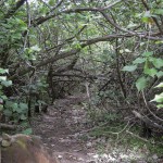 I hike a bike it across the dry streambed and find myself on a well worn path through hau thickets. In places the clearance is pretty low, but it quickly opens up. Again this path is not really bicycle friendly. There are rideable stretches, but as it gets further in that quickly diminishes.
 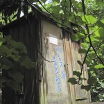 I come across a wood shack that is labeled as a USGS stream gauging station. The trail is following a streambed so is filled with numerous rocks of various sizes, again making for extreme bicycle challenging terrain. I come to the first flowing stream crossing. These are included in the 25 stream crossing count talked about in hiking books. I pick my way across this one only to find yards later it cross back, and visible just beyond it criss crosses yet again.
 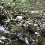 I decide this is about the extent of what I want to struggle with today. I turn around and head back to the road. It’s a straighforward ride out from here, but I watch my speed carefully as I know there are hikers and dogs on the trail. I find the hunters are still looking for their dog(s), they’ve now deployed a radio tracking antenna that any kid from our generation should recognize from Mutual of Omaha’s Wild Kingdom. I also come across a young family and stop to chat for a bit. (Dave’s radar would be going off) Just as I near the end of the gravel road, I catch up to two 4×4 pickups leaden with Da Boyz who are on their way out from a fruitful day with a large boar strapped across the bed of the lead truck.
I cruise behind them. They have the key to the gate which makes for easy exit instead of threading through the side opening. 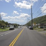 I hit the road and enjoy the downhill spin. I catch up to someone cruising down the road on an older Foes with a BoXXer. I recognize him as one of the old time Bike Factory crew, I think Garret was his name. I remember seeing him doing wheelies on a beach cruiser. We chat for a bit, he’s now got a bike (motorcycle) shop going in Mapunapuna. He splits off at the freeway underpass. I continue on into Salt Lake. Ugh, I’m out of shape, I feel the twinges of cramps in my legs just as I come to the dip in Salt Lake. I take it easy climbing out, and fortunately everthing is downhill now to the car shop.
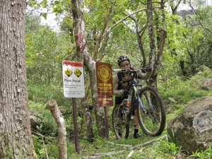
It was interesting to explore a trail I’ve never been on. Not really the most interesting riding trail. Out and back roughly 7-8 miles round trip of gravel road. I’m curious about the hiking trails, but the length of gravel road to get to the trails is not thrilling. Oh, and it would be wise to heed the flash flood hazard warning signs at the trailhead. Seeing how it is on a valley stream, you would not want to be there on a heavy rain event. This season has been dry so I think I timed my visit well.
Complete pics HERE.
Nice. To avoid all the Salt Lake stuff, you can go up Pu’uloa Road and cross over the freeway to where it becomes Jarret White. After a short climb, turn left at the first traffic signal down the little spur of Mahi’ole and take the right at the T at the bottom. After passing the Hawaiian Tel substation on the left, you’ll see a footpath at the end of the cul-de-sac that leads along the side of the freeway Moanalua off-ramp into the valley. You’ve probably seen joggers and walkers on the path if you’ve been along this stretch of the freeway.
Ah, dammit, that must be where Bike Factory dude went. Was wondering if there was a better way to get there & back but didn’t know what happened when you keep going on Puuloa and end up at all the freeway on & off ramps.